Totternhoe Knolls accessible countryside site

Totternhoe Knolls combines history with wildlife and landscape. The medieval motte and bailey castle gives stunning views over the surrounding countryside and the chalk grassland has a wealth of wildlife to see.
In the summer the grassland blooms with wildflowers and these attract butterflies and other insects.
Path information
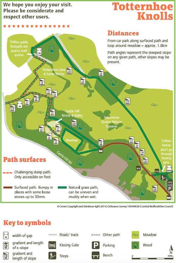
The surfaced path begins at the kissing gate before the car park height barrier. This route up to Castle Hill and around the meadow is the most accessible for wheelchairs and pushchairs. The grass path leading to Castle Hill is firm when dry.
Paths over and beyond Castle Hill are steep and narrow and are only suitable for access on foot. The map shows types of paths, slopes etc. to help you decide which route is suitable for you.
Visitor information
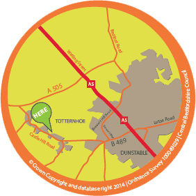
- free parking available next to picnic site, off Castle Hill Road (height restriction: 1.8 metres)
- accessible parking space
- nearest public toilets are in Dunstable town centre, or at the Chilterns Gateway Centre, Dunstable Downs
- refreshments from pubs in Totternhoe
- Totternhoe Knolls is owned and managed by us, the Wildlife Trust and the National Trust
Map of Totternhoe Knolls countryside site
Download map of Totternhoe Knolls (PDF 987.4KB) ![]()
